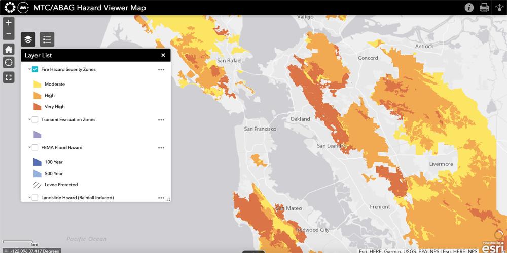
The Hazard Viewer is a one-of-its-kind interactive map of regional hazards, curated from the most relevant, current maps for the nine-county Bay Area. It brings together the best set of mapping resources that exist in the region for each hazard.
Get more details about the Hazard Viewer.
An easy-to-use tool for contextualizing local risk at the household-, neighborhood-, jurisdiction- and county-level, the Hazard Viewer includes layers for viewing:
- Historic wildfire perimeters
- Fire hazard severity zones
- Tsunami evacuation zones
- Federal Emergency Management Agency (FEMA) flood hazard
- Landslide hazard (rainfall-induced)
- Earthquake fault zones
- Probabilistic earthquake shaking hazard
- Earthquake liquefaction susceptibility
- Earthquake deaggregation
- Earthquake shaking scenario maps for 16 local faults and fault segments
Sea level rise map viewers are available through the BCDC Adapting to Rising Tides program (see below).

