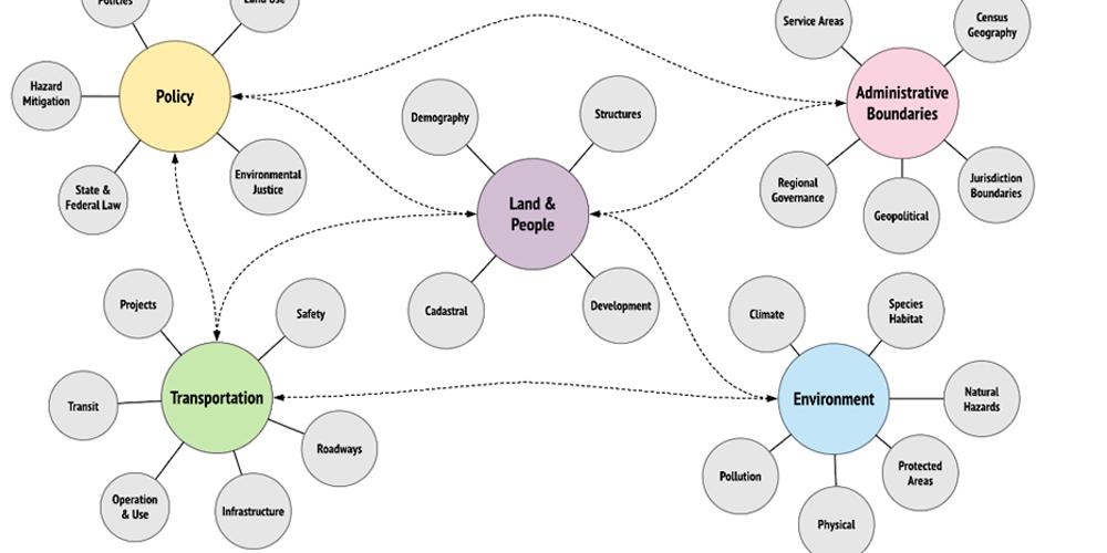
BASIS — Bay Area Spatial Information System
The Bay Area Spatial Information System, or BASIS, is a new open-data initiative operated by ABAG and MTC to offer key regional datasets for the public to download — or access via API for analysis and modeling.
Visit BASIS to review and download data for regional forecasts and long-range planning decisions.
Many of our key regional datasets are sourced from local jurisdictions and include data such as land use, zoning, residential planning and a host of related datasets that describe the development pipeline activity for the Bay Area… all of which are directly related to Plan Bay Area.
Plan Bay Area 2050+
Plan Bay Area 2050+ is the Bay Area's long-range plan for housing, the economy, transportation and the environment. It outlines how the Bay Area can adapt to future growth over the next three decades.

