These custom-crafted maps are developed by ABAG and MTC’s mapmakers who turn data into art to tell compelling stories about important trends in the Bay Area, across the nation and around the world.

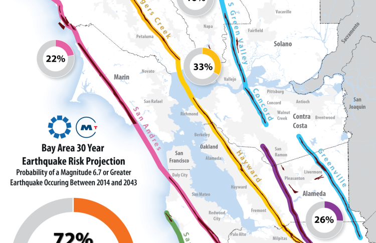
Bay Area 30 Year Earthquake Risk Projection
On Monday, October 9th, 2017 the Bay Area experienced a 4.1 earthquake about 12 miles east of San Jose near the Calaveras Fault. The small jolt-and-roll caused no damage but served as a not-so-gentle reminder that the Bay Area rests upon a number of restless faults. According to the United States Geological Survey (USGS), there is a 72% likelihood that the Bay Area will experience a magnitude 6.7 or greater earthquake over the next 30 years. For context, the 1989 Loma Prieta earthquake, with a magnitude of 6.9, was responsible for 63 deaths and severely damaged elevated transportation infrastructure in San Francisco and Oakland. The fault with the greatest likelihood of earthquake is the Hayward-Rodgers Creek Fault, which runs roughly from East San Jose in Santa Clara County to Santa Rosa in Sonoma County. When considering earthquakes, it is important to remember that the magnitude scale is logarithmic, meaning a 7.0 earthquake would release 33 times more energy than that of the 6.0 South Napa Earthquake which occurred in 2014.

