These custom-crafted maps are developed by ABAG and MTC’s mapmakers who turn data into art to tell compelling stories about important trends in the Bay Area, across the nation and around the world.

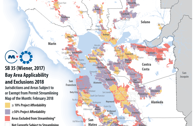
SB35 Bay Area Regional Determination
This month's Map of the Month identifies locations where Bay Area jurisdictions are required by Senate Bill 35 to streamline the approval process for housing developments that meet certain requirements. A jurisdiction is subject to SB 35’s streamlining requirements if it has not made sufficient progress toward its Regional Housing Need Allocation (RHNA) goals, or if it failed to submit its latest Housing Element Annual Progress Report. Jurisdictions that did not permit enough above-moderate income units to meet a pro-rata share of their above-moderate income regional housing need for the current housing element cycle, are subject to SB 35 streamlining for projects that dedicate a minimum of 10 percent of units to be affordable to lower-income households. Jurisdictions that did not permit sufficient lower income units (very-low and low-income) to meet a pro-rata share of their very-low and low-income regional housing need for the current housing element cycle, are subject to SB 35 streamlining for projects that dedicate a minimum of 50 percent of units to be affordable to lower-income households. Although the determination of RHNA progress applies to the jurisdiction as a whole, certain locations, such as the coastal zone or prime farmland, are excluded from the streamlining requirements (see areas in red on second map).

