

These custom-crafted maps are developed by ABAG and MTC’s mapmakers who turn data into art to tell compelling stories about important trends in the Bay Area, across the nation and around the world.
Did You Feel That?
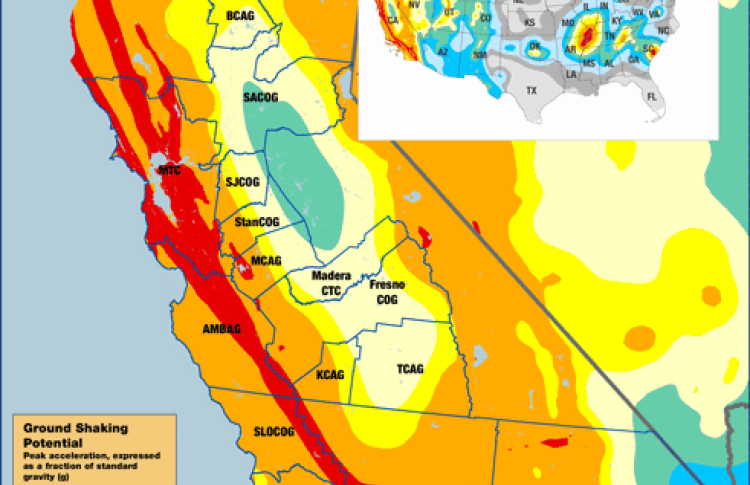
The U.S. Geological Survey has recently released new earthquake hazard maps for the nation, expanding seismic risk areas in California and along the East Coast. As in past estimates, the threat of earthquakes is highest along the West Coast, the Intermountain West -- that region between the Rocky Mountains and the Cascade Range -- and several areas in the central and eastern United States. According to the report, the 16 states with the highest risk include Alaska, Arkansas, California, Hawaii, Idaho, Illinois, Kentucky, Missouri, Montana, Nevada, Oregon, South Carolina, Tennessee, Utah, Washington and Wyoming. In California, the discovery of new faults raised hazard estimates for San Jose, Vallejo and San Diego. However, due to new understanding of earthquake fault processes, researchers downgraded threat estimates for Irvine, Santa Barbara and Oakland.