These custom-crafted maps are developed by ABAG and MTC’s mapmakers who turn data into art to tell compelling stories about important trends in the Bay Area, across the nation and around the world.

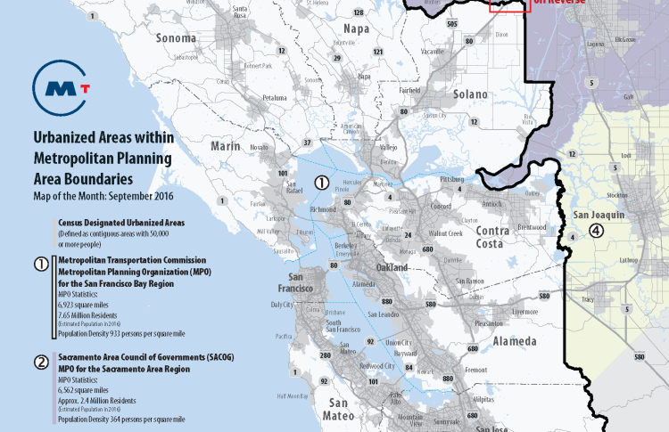
Urbanized Areas Within Metropolitan Planning Area Boundaries
This map shows Census designated urbanized areas that extend into the jurisdiction of an adjacent Metropolitan Planning Organization. There are two such urbanized areas within the jurisdiction of MTC; one in Davis, which extends from the Sacramento Area Council of Government's jurisdiction and the other in Santa Clara County, which extends into the jurisdiction of the Association of Monterey Bay Area Governments. Under a proposed federal planning rule, even though such areas comprise 0.01 percent of MTC's population, we would be required to merge with AMBAG and SACOG or develop a joint Regional Transportation Plan and joint performance measures. We have created a simple animated map that highlights these areas in greater detail.View Map Animation

