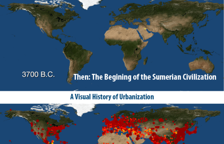
These custom-crafted maps are developed by ABAG and MTC’s mapmakers who turn data into art to tell compelling stories about important trends in the Bay Area, across the nation and around the world.

History Of Urbanization:
How were cities distributed globally in the past? How many people lived in these cities? How did cities influence their local and regional environments? This month's map seeks to answer these questions by illustrating the worlds population growth within cities over a span of 6,000 years. According to the map authors, By 2030, 75 percent of of the world's population is expected to be living in cities. Today, about 54 percent of us do. In 1960, only 34 percent of the world lived in cities. This map is based upon research conducted by Scientific Data in June of 2016, and represents the first spatially-explicit dataset of urban settlements from 3700 BC to AD 2000. The dots on the map represent the approximate location and size of urban populations worldwide.

